Esri: Seeing What Others Can’t
6/29/2026
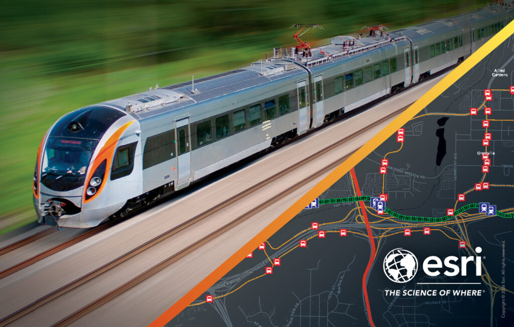
How an Enterprise GIS Transforms Transit
SPECIAL ADVERTISING SECTION

What if, as CEO, you could view your entire transit network in operation at a glance? What if, as a division facilities director, you could provide visual, location-based feedback to executives instead of a static or verbal report? What if, as a security chief, you could quickly perform a comprehensive risk assessment using inputs from maintenance, operations and customer service without leaving the command center?
This isn’t the future. It’s now—if you adopt an enterprise approach to location.
Every transit decision depends on understanding location—where things happen in and around their system. Yet too many agencies still treat spatial data as siloed maps pulled together on special occasions. An enterprise geographic information system (GIS) stitches those silos into a unified spatial fabric so leadership can see context instantly and act decisively.
Leading agencies are already using GIS to modernize operations, meet mandates and build transit systems riders can count on. Planners visualize how people move through networks, highlighting high‑demand corridors and revealing trip origins and destinations. Transit analytics make trends comparable over time so leaders can prioritize route changes and corridor investments with confidence. This is because Esri’s ArcGIS software embeds location into workflows, connecting data across departments to power smarter planning, real‑time operational awareness and safer systems.
ArcGIS also supports streamlining State of Good Repair reporting and reduces administrative effort and risk by keeping stakeholders aligned with accurate, up‑to‑date information. Live maps and analytics surface bottlenecks, detours and headway issues across bus and rail networks in near real time. Alerts are pushed to dispatchers and management centers so crews can intervene early, protecting service reliability and boosting on‑time performance. Your facility and operations teams would willingly trade stacks of reports for live visual briefings where geographic patterns can reveal the systemic issues they need to fix. They can easily diagnose recurring failures and prioritize spending and maintenance before an asset gets out of safe operation. When seeking funding allocations, teams can use those visual narratives to accelerate approvals because boards and nontechnical stakeholders grasp the implications of investments immediately.
Security and safety teams benefit too, as embedding GIS‑derived location intelligence into operations powers workflows more effectively than schematic maps and pushpins do. For example, the ArcGIS spatial analytics suite enables hot spot detection that drives dynamic, risk‑based patrols for more effective deployments. Emergency management personnel can shift from reactive incident handling to proactive risk mitigation, including rehearsing scenarios for disaster response and coordinating multi-agency responses from a shared operational picture. For headline events like the World Cup, the Olympics, or major concerts, this shared view reduces friction, improves response times and builds rider trust.
And considering riders, the customer experience is integral, not ancillary. When feedback, service metrics and spatial context coexist in the same platform, agencies can prioritize improvements that matter most to riders. We can use GIS to simplify navigation with clear signage, maps, and intuitive wayfinding powered by ArcGIS. Publishing consistent, up-to-date, location‑aware guidance across apps, station displays and web portals is important for the customer to know where to go and what to expect. We can also collect feedback tied to places and trips to surface pain points and measure the impact of changes, especially on those for whom transit is a lifeline.
Get Started with ArcGIS
Practicality matters. Most agencies already possess GIS, sensor networks and asset data. ArcGIS integrates existing investments—rather than requiring wholesale replacement— through an assembly of live feeds, analytics and controlled operational views. These can be shared with executives, field crews and partner agencies and enable true cross‑agency collaboration. Adopting enterprise GIS is a leadership decision as much as a technology choice. Part of what drives success is clear accountability for the geospatial layers, prioritizing integration with AVL, asset management and other operational systems, and making geospatial briefings part of routine executive and incident workflows. Success also requires testing the system in major‑event planning and multi-agency drills so technology and people mature together.
Let’s advance transit’s ability to optimize its resources. Transit is complex and location‑based; its tools should reflect that reality. Take the enterprise approach to GIS today: Unify your data, operationalize spatial analytics and put the power of “where” at the center of decision‑making.
Anika-Aduesa Smart
Industry Solutions Manager, Esri
https://www.esri.com/en-us/industries/transit/overview