Esri: The Route Ahead with GIS
4/15/2026
SPECIAL ADVERTISING SECTION:
Transit, we have a decision to make.

We can continue juggling spreadsheets, siloed dashboards, and ad hoc reports, or we can take a location centric approach and use technology to coordinate our whole picture, the way it should be used.
Esri’s geographic information system (GIS) software is the enterprise technology you need to embed location throughout your business workflows.
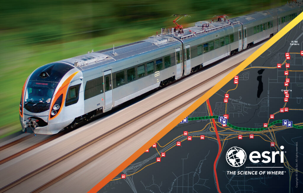
Imagine a world where every bus, train, and piece of infrastructure lives on a single, continuously refreshed map. Real‑time vehicle locations, passenger counts, maintenance sensor feeds, weather conditions, incident alerts, and city events all converge in one place. That shared map becomes the brain of the transit system, feeding refined geospatial artificial intelligence (GeoAI) algorithms that can predict where riders will need service, warn you of equipment that’s about to fail, and suggest the most efficient routes for both vehicles and passengers—all without leaving the same platform.
Here are some of the ways this holistic tech-operation solution helps agencies achieve higher quality and higher efficiency paratransit service.
The vision is simple yet powerful: a GeoAI-driven operations hub that turns points, lines and polygons into actionable intelligence. Predictive models built on recurrent neural networks would ingest historical vehicle locations, passenger counts, and external contexts such as weather or special events. By learning the patterns of rider demand across neighborhoods, the system could generate heat maps that tell dispatchers where service will be needed in the next hour. At the same time, streams of sensor data from tracks, bridges, and vehicles would be evaluated by risk‑scoring models. When a sensor indicates an elevated risk of failure, a work order would be automatically created, allowing maintenance crews to intervene before a breakdown occurs. Reinforcement‑learning agents could balance passenger loads, tap into live traffic feeds, and adjust routes on the fly, delivering personalized route recommendations to riders on their phones in real time.
All of these insights would flow directly to the tools agencies already use—dispatch consoles, rider apps, and asset‑management dashboards—without the need for custom integrations or duplicate data entry. The map becomes the single source of truth, and every downstream system simply reads the latest visualizations and alerts.
A shared spatial view does more than streamline technology; it transforms the people who run the system. Legacy staff can translate years of operational know‑how into spatial queries and visualizations, turning tacit expertise into actionable intelligence. New hires, already digitally fluent, can plug their analyses into the same platform and instantly see how their work influences real‑world routes, crowding patterns, and asset health. Because every decision is anchored to “where,” the agency creates a universal language that bridges departments, partners, and external stakeholders, fostering collaboration and aligning everyone around a single, powerful perspective of the agency’s mission.
What’s more, when every transit agency in a region runs on a common GIS platform, the entire transportation ecosystem instantly speaks the same spatial language. During major events, planners can overlay event venues, crowd density forecasts, road closures, and real-time vehicle locations on a single map. This unified view enables coordinated service adjustments, dynamic rerouting, and precise asset location data for emergency responders. The result is a seamless regional response that maximizes capacity, minimizes congestion, and protects riders, turning what could be chaotic, fragmented actions into a synchronized, data‑driven operation.
The technology needed is already proven and affordable. A cloud-based spatial database holds all your location data in one place. GeoAI tools on the ArcGIS platform run the predictive models, while simple web services deliver the results as easy‑to‑read maps and charts. Role‑based access keeps sensitive information secure while still allowing collaboration across departments. Good governance—centralized data catalogs, rich metadata, automated testing, and regular model updates—ensures the system remains reliable. StoryMap visualizations turn performance numbers into narratives that executives, finance teams, and frontline staff can all understand. The agency wins can be communicated on a public-facing hub for accountability, feedback and support.
GIS use is growing exponentially across industries, including transit agencies just like yours, worldwide. Get on board—embrace the map-centric, AI-enhanced geospatial approach, and start your journey towards good data, better technology, and best practices in a single, cohesive system. Begin with a discovery workshop to map your current data sources and identify quick‑win opportunities. We’ll help you take it from there.
The choice is yours, Transit, you’ve got this. Let’s go.
Anika-Aduesa Smart
Public Transit Industry Director
To learn more about GIS within the transit industry, please visit link.esri.com/BetterTransit and let us know how we can best partner with you.